SERVICES
Land surveying services provided by Obiora Anyika & Associates
At Obiora Anyika & Associates, our area of expertise is offering thorough land surveying services to satisfy our clients’ various needs. With our experience, you can be sure that the exact, dependable, and comprehensive surveys you need for a range of land management and development initiatives will be provided. The main land surveying services we provide are as follows:

Boundary Surveys
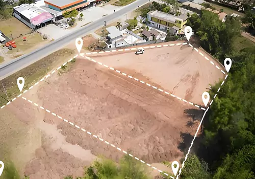
The precise borders of a property are ascertained by our boundary surveys. This service is essential for settling conflicts, drawing property lines, and guaranteeing legal conformity. We offer accurate measurements and unambiguous paperwork to safeguard your property rights.

Topographic Surveys
Mapping a site's physical characteristics, such as its natural and man-made structures, is the goal of topographic surveys. These surveys give a thorough understanding of the site's topography, elevations, and characteristics, which is crucial for planning and design purposes. Architects, engineers, and developers can use this knowledge to make well-informed decisions.

As-Built Surveys
Confirms that the construction is being carried out in accordance with the design plans, which specify the locations of the utilities and structures.

Construction Surveys
To guarantee that your project is constructed in accordance with the design parameters, we provide construction surveys. Throughout the building process, our team's precise and trustworthy measurements help to preserve quality and avoid expensive mistakes. Stakeouts, as-built surveys, and alignment checks are some of these surveys.

Subdivision Survey
Large tracts of property are divided into smaller lots by subdivision surveys, each of which complies with local zoning and regulatory standards. This service promotes development, increases property value, and maximizes land usage. Our subdivision surveys offer precise measurements and maps that serve as a roadmap for the whole subdivision procedure.

Site Planning Survey
Surveys for site planning are essential for starting development projects. We gather and examine information about a site's terrain, existing structures, utilities, and other physical characteristics. Architects, engineers, and developers may create site plans that are sustainable and productive with the help of this extensive mapping.
Our team is here to help
Please click the button,fill out the form and one of our representatives will get back to you as soon as possible.
